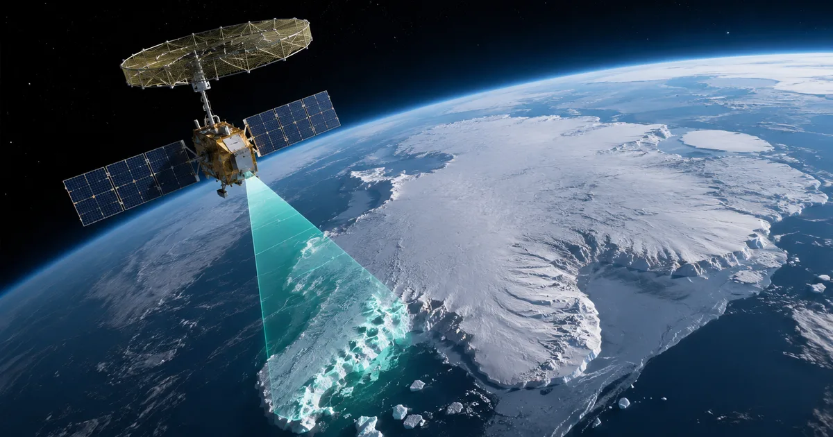
You've probably seen the picture by now. The new NISAR satellite Antarctica image looks exactly like a giant hummingbird carved into the ice. And honestly, it's one of the coolest things to come out of space tech this year. I think it's a massive deal.
There is serious science happening here. This joint mission between our own ISRO and America's NASA is literally changing how we look at the Earth.
So, what is going on with that bird in the ice? And why should anyone sitting in Delhi or Mumbai care about it?
What exactly is the NISAR mission?
NISAR stands for NASA-ISRO Synthetic Aperture Radar. It's the most expensive Earth observation satellite ever built.
We're talking about a project worth around $1.5 billion. In Indian rupees, that's around ₹12,500 crore. ISRO's share of the cost is somewhere near the ₹800 crore mark. The numbers here are a bit fuzzy, but it's a huge investment.
Thing is, this satellite is entirely unique. It's the first space mission ever to carry two different radar systems at the exact same time.
- An L-band radar developed by NASA in the US
- An S-band radar developed by ISRO in India
We need two radars because they do different things. The NASA L-band radar is great at penetrating dense forests and deep ice to see what's happening underneath. The ISRO S-band radar is better at looking at crop health and the surface of the soil.
Combine them, and you get a machine that can see almost everything. It tracks changes on the Earth's surface down to fractions of an inch. That's crazy precision. (I know, it sounds a bit much, but that's the actual capability of this thing).
The story behind the Antarctica hummingbird
The NISAR satellite Antarctica image shows a massive shape in East Antarctica that looks exactly like a hummingbird in mid-flight.
I know, it sounds like something from a sci-fi movie. It isn't.
What you're actually looking at is a feature called a nunatak. That's a fancy geological term for a peak of rock sticking out above the surface of a glacier or ice sheet. The radar signals from the satellite bounce off the rock differently than they bounce off the surrounding ice. This creates the bright, bird-like pattern in the data.
But the real story isn't the shape itself. The real story is what this image proves about the satellite's capabilities.
Before NISAR, getting this kind of detailed view of ice structures under the surface in Antarctica was incredibly difficult. Optical satellites are useless when there are clouds. They're also useless during the six months of darkness in the Antarctic winter. Radar doesn't care about clouds or darkness. It just works.
Now, scientists can map these hidden mountains and valleys with unbelievable clarity. If you ask me, that's the best part.
"The NISAR data gives us an unprecedented look at how ice sheets are interacting with the bedrock underneath them. This is critical for predicting how fast they might melt." - Statement from NASA JPL
And yes, the public can actually access this data now. They opened it up on July 20, 2026. Teams in both the United States and India are actively analyzing these data sets as we speak. They're downloading massive files to process the radar returns.
Why this matters for India right now
You might be wondering why India is spending ₹800 crore to look at ice in Antarctica. It seems completely disconnected from our daily lives. Look, I get it.
But what happens in Antarctica directly impacts what happens in Mumbai and Chennai.
The ice over there is melting. When it melts, sea levels rise. If sea levels rise too much, our coastal cities face massive flooding risks. Millions of people live right on the coastline. The NISAR satellite helps scientists track exactly how fast that ice is moving and melting. This gives governments decades of advance warning to build sea walls or shift infrastructure.
And that's just a small part of what it does.
Tracking agriculture and water resources
This satellite passes over India regularly. It maps the entire globe every 12 days. Over India, it tracks soil moisture and crop health. For an agricultural economy like ours, this data is absolute gold.
Think about the monsoon. It's getting more erratic every year. We have droughts in some districts and floods in others simultaneously. The S-band radar from ISRO can monitor flooding in real-time. This helps the government and agencies like the NDRF respond faster during disasters. It can tell farmers when their crops are stressed by lack of water before the plants even turn brown. In my experience, having that kind of heads-up is huge.
We can use it to monitor deforestation in the Himalayas or track the shifting course of rivers in Assam. It helps measure ground subsidence. Meaning it can tell us if a city is slowly sinking, much like the alarming reports we saw from Joshimath a few years ago. Basically, it gives us a real-time pulse of the country's natural resources.
How radar imaging actually works
Most people think satellites just have giant cameras attached to them. That's true for some. But not for NISAR.
Optical cameras need sunlight. If it's night, or if it's cloudy, an optical satellite just takes a picture of the top of the clouds.
Synthetic Aperture Radar works completely differently. It actively shoots radio waves down to the Earth and measures how they bounce back. Because it generates its own energy, it can see through clouds and total darkness.
The synthetic aperture part is a clever trick. A real antenna large enough to get high-resolution images from space would be too big to launch on a rocket. So, the satellite uses its own motion along its orbit to simulate a much larger antenna. It's a brilliant piece of engineering, honestly.
And because it uses two different wavelengths, it gathers completely different types of information.
- The L-band has a longer wavelength of about 24 centimeters. It can push right through the canopy of a thick jungle and hit the branches and trunks below. It can push through the top layer of dry snow to see the solid ice beneath.
- The S-band has a shorter wavelength of about 9 centimeters. It bounces off the leaves and smaller branches. It gives a clear picture of what is happening right at the surface of crops.
When you combine them, you get a 3D understanding of the environment. You know how thick the ice is, and how much the ground has shifted since the last time the satellite flew over.
The engineering behind the giant reflector
One of the craziest parts of this satellite is the antenna itself. You can't just launch a massive radar dish into space. It wouldn't fit inside any rocket.
The teams at NASA and ISRO had to design a 39-foot wire mesh reflector that folds up like a complicated umbrella. Once the satellite was safely in orbit, it slowly unfolded this giant golden mesh. I'm not sure exactly why they picked gold, but it works perfectly. If that deployment had failed, the entire ₹12,500 crore mission would have been useless.
But it worked perfectly. That giant reflector catches the signals bouncing back from Earth and funnels them into the receivers. It's currently the largest radar reflector ever launched into space.
It has a massive amount of data to send back. We're talking about terabytes of raw information every single day. The satellite has to beam this data down to ground stations in India and the US. Then supercomputers crunch the numbers to turn those radio signals into the images you see in the news.
Beware of satellite image scams
Because the Antarctica hummingbird image went so viral across Indian social media, a lot of fake images are suddenly popping up on WhatsApp and Telegram groups.
People are sharing AI-generated pictures. These pictures claim the satellite found alien bases or lost treasures in the ice. Some are even using these fake images to push investment scams. They claim they have satellite proof of new gold deposits, and they ask people to invest via sketchy UPI links.
Don't fall for it. It's a mess.
Here are a few ways to check if an image or claim is actually from the NISAR mission:
- Check the source. Real NISAR images will always be published on official NASA (.gov) or ISRO (.gov.in) websites first, or covered by legitimate news outlets.
- Look at the colors. Radar images aren't regular photographs. They are usually color-coded by scientists based on data, so they look a bit unnatural, often using bright blues, purples, or yellows to represent different surface textures. They don't look like high-resolution drone photos.
- If a message asks you to click a link to see the secret footage or asks you to download an APK file to view satellite maps, it is a scam. Just ignore it and block the sender. You can report these kinds of financial scams to the 1930 helpline or the National Cyber Crime Reporting Portal at cybercrime.gov.in.
You can always check the official ISRO Twitter handle or the NASA JPL website for the real updates. It's the safest bet to avoid getting fooled.
What happens next with the open data?
Now that the data is publicly available, researchers around the world are digging into it.
We're going to see a flood of new scientific papers over the next year. They will map the exact speed of glaciers in Greenland and Antarctica. They'll give us accurate assessments of global forest cover.
For India, the applications are endless. The National Remote Sensing Centre in Hyderabad is heavily involved in processing the S-band data. They'll provide actionable intelligence to various ministries, from agriculture to disaster management.
Imagine a scenario where the government can accurately predict crop yields for the entire country months before the harvest. They can do this just by analyzing the radar data. That helps control food prices and manage exports. Or imagine being able to detect the exact boundaries of an oil spill in the Arabian Sea at night. This lets cleanup crews respond immediately. It could even help track illegal mining activities. The satellite monitors ground deformation over time to catch those activities.
That's the real power of this mission. It turns abstract science into tools that solve actual problems. (Which makes sense, actually, given the huge investment).
The bottom line
The NISAR mission is a massive win for science. And it's a proud moment for India's space program.
We're long past the days of India just playing catch-up in space technology. We are building the critical components that make these massive global missions possible. The S-band radar built right here in India is providing data. Scientists in the US and Europe are relying on it.
The data coming from this satellite over the next few years will shape how we handle agriculture and infrastructure planning for the next decade. In my experience, government planning needs all the good data it can get.
The hummingbird image is just a fun little preview of what this machine can do. I'm genuinely curious to see what they find next. It's going to change how we understand our own planet.