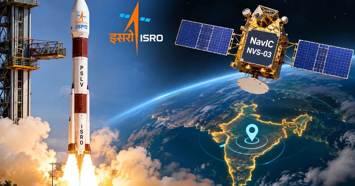
Late Friday night, ISRO fired its GSLV-F18 rocket into the dark sky over Sriharikota and pulled off the ISRO NavIC NVS-03 satellite launch, an operational milestone India desperately needed. At 11:51 PM IST, the 2,250 kg spacecraft separated cleanly into orbit, fixing a quiet crisis that had stalled our homegrown navigation system. NavIC was running on only three operational satellites after past hardware failures, so the network couldn't reliably calculate positions on its own. With NVS-03 in place, India has hit the four-satellite mark required to restore civilian positioning services across the subcontinent.
Honestly, most people never noticed, but our navigation network was practically running on fumes for months. You still saw that blue dot on Google Maps, sure (even if it jumped around occasionally). But if you ask me, almost nobody realized your phone was leaning entirely on American GPS and European Galileo satellites just to figure out which side of the street you stood on.
That changes right now. Here's what actually went down at Sriharikota, and why this launch matters so much for anyone navigating Indian streets.
Why the NavIC system broke down and how NVS-03 fixes it
To understand why folks at the Satish Dhawan Space Centre looked so visibly relieved on Friday, you've got to rewind a little. India started building the Indian Regional Navigation Satellite System, which we call NavIC, way back in 2013. The whole plan was to keep seven satellites hovering over South Asia. But space hardware is brutal. Three imported European rubidium atomic clocks on the early IRNSS-1A satellite failed completely. After that, later satellites ran into similar clock troubles and orbital decay, so engineers had to keep scrambling to launch replacements just to keep the network alive.
Then ISRO pushed forward with its second-generation NVS series. These new birds came with much heavier payloads and domestic atomic clocks. NVS-01 made it to orbit just fine. But NVS-02 ran into some nasty technical snags that wrecked its full operational mission (I'm not sure of every single detail behind that glitch, but it was a real mess). And that failure left NavIC stranded with just three working satellites up there.
Basically, three might sound like plenty. In satellite navigation, it's zero.
Why does navigation math need four satellites instead of three? I think people forget that your phone has to solve for four separate numbers:
- X-axis position to establish your East-West location on Earth
- Y-axis position to establish your North-South coordinate
- Z-axis position to calculate your exact altitude above sea level
- Time bias correction to sync your phone's cheap quartz clock with the satellite's atomic clock
Miss that fourth signal, and your location drifts by hundreds of meters within a couple of minutes.
"We already have three functional satellites, but with this satellite we have the minimum satellites needed to restore NavIC's PNT services. This was one of the most optimal performances achieved by any launch vehicle in the world." — V Narayanan, ISRO Chairman
This time around, ISRO nailed the injection. They slipped NVS-03 into a geosynchronous transfer orbit with an apogee of 38,080 kilometers and a perigee of 170 kilometers. The GSLV rocket, which engineers used to call the "naughty boy" because of early cryogenic hiccups, pulled off its 20th flight without a single stumble. Even better, turnaround time was only 56 days after the GSLV-F17 launch in September.
The civilian L1 band rollout changes everything for mobile makers
If you follow phone launches in India, you've probably seen NavIC listed on spec sheets for years. But in my experience, if you opened an app like GPSTest to see what was actually going on, your phone rarely ever locked onto an Indian bird. A simple frequency mismatch held everything back.
Thing is, first-gen NavIC satellites broadcast only on two bands: L5 at 1176.45 MHz and S-band at 2492.028 MHz. Meanwhile, standard civilian GPS everywhere else runs on the L1 frequency at 1575.42 MHz. Chip giants like Qualcomm and MediaTek build their cheapest silicon specifically around that L1 signal. Stuffing extra L5 antennas and RF filters into a budget handset pushes up hardware costs fast (annoying, I know).
Brands selling phones between ₹10,000 and ₹15,000 just didn't want to spend extra cash on a regional band unless government rules forced their hand. You can read more about how smartphone chipsets handle multi-constellation radios in our detailed tech explainers, where we break down silicon architecture.
So ISRO adapted. Starting with NVS-01 and now with NVS-03, every new satellite carries a civilian L1 band signal alongside the older L5 and S-band frequencies.
That one change is huge. Your phone won't need any weird, specialized chips. It can pick up NavIC using the exact same antenna and radio circuits it already uses for standard GPS.
What this means for 5G smartphone support and Indian navigation apps
The timing here fits neatly with mandates from the Ministry of Electronics and Information Technology. The government told smartphone brands a while back that every 5G phone sold in India has to support NavIC. Brands kicked up a fuss at first, arguing that forced L5 hardware would make entry-level 5G phones way too pricey for students and small shopkeepers in tier-2 towns.
Now that L1 is working in space, that cost complaint is pretty much dead. Chip makers have already slipped L1 NavIC support into their current 5G platforms, so phones rolling out this year can connect right out of the box.
Look, you should definitely expect native support in upcoming phones like the Redmi 17 5G and other budget devices that sell by the truckload during Diwali sales. And if you ask me, the way your phone actually handles navigation behind the scenes is way cooler than people realize.
Both Android and iOS rely on a tool called the fused location provider. Whenever you open Google Maps to check your route, hail a cab on Uber, order dinner on Zomato, or browse nearby spots, your phone's operating system pulls signals from every constellation it can reach. It combines signals from GPS and Galileo with BeiDou and NavIC data into a single Positioning, Navigation, and Timing (PNT) calculation.
You won't ever know which satellite gave you your coordinates at 8:15 PM on a Tuesday. But you'll definitely notice that your blue dot stops hopping across parallel flyovers and snaps straight to your service road much quicker (which makes sense, actually). That kind of reliability saves a lot of headaches when you're driving in a crowded city.
Comparing NavIC and GPS accuracy on Indian roads
When you pit them head-to-head on Indian streets, NavIC has some very clear physical advantages over GPS.
GPS satellites orbit in Medium Earth Orbit around 20,200 kilometers up, and they're constantly moving across the sky. At any given minute over Delhi or Mumbai, only a few GPS birds sit high overhead. The rest hover down near the horizon where tall apartments and elevated metro lines easily block their line of sight.
NavIC is built completely differently. Its spacecraft sit in Geostationary and Geosynchronous orbits parked nearly 36,000 kilometers up above the equator and the Indian Ocean. They stay perched directly above us, tracing a gentle figure-eight path that stays locked over South Asia all day long.
Because these satellites stay so high up, their signals hit your phone at steep, nearly vertical angles. If you're walking through packed gullies like Chandni Chowk in Delhi or Crawford Market in Mumbai, NavIC beams drop straight down between buildings. In my experience, that's where standard GPS fails you on Indian roads: signals coming in sideways bounce off walls and get scrambled.
ISRO built NavIC to give positioning accuracy within 10 meters across India, extending roughly 1,500 kilometers beyond our borders. If you have a specialized dual-frequency receiver, that error drops under 5 meters (the real-world numbers get a bit fuzzy depending on local interference, but it's still way sharper than basic single-frequency GPS in South Asia).
This accuracy helps far beyond regular cab apps. The Ministry of Road Transport and Highways is already rolling out satellite toll collection on highways to ditch toll plazas altogether. If highway tolling depends on sketchy GPS fixes, a sloppy position could charge you expressway tolls when you're just driving down a side road. Precise NavIC tracking prevents those messy billing mistakes before they start.
Commercial fleet tracking, Aadhaar biometric attendance, state bus monitoring, and emergency alerts for coastal fishermen all rely on these exact coordinates.
What happens next for India's regional constellation
Having four working satellites up there means NavIC is back on its feet, but ISRO can't hit the brakes just yet. Four is the absolute bare minimum to get a fix. If a single satellite runs into a power glitch or thruster failure tomorrow, the entire network slips below the red line and stops functioning on its own (which isn't much of a safety margin, honestly).
That's why ISRO is already prepping the NVS-04 and NVS-05 launches to create a solid cushion of five to seven working birds. We'll be keeping a close eye on launch schedules and orbital maneuvers in our daily tech news coverage as the teams finalize their next window.
The real quiet triumph aboard NVS-03, though, is the indigenous atomic clock. Crafted by the Space Applications Centre in Ahmedabad, this rubidium clock rides along with imported units. And I think that's the biggest geopolitical takeaway here. Back during the 1999 Kargil war, the US famously cut off military GPS access across the region, which left Indian troops completely blind without positioning coordinates. That bitter experience taught Indian defense planners that depending on foreign GPS networks was a massive risk.
Now, with our own clocks and our own rockets, India controls the whole chain from ground stations right into orbit.
Curious if your phone can see NavIC right now? Grab an app like GPSTest off the Google Play Store. Step out into the driveway, fire up a scan, and check if any satellites show up with the Indian tricolour flag or the IRNSS tag.
If you're carrying a newer mid-range or premium phone, you might already spot one or two satellites pop up on your screen. Once ISRO wraps up in-orbit tests on NVS-03 and turns on the civilian L1 feed, that number is going to jump. It took years of frustrating failures, but our homegrown navigation network is finally showing up where it counts.